Construction Technology
CT Wilson utilizes technology to tailor construction to meet your project’s requirement for functionality and aesthetics while meeting timelines and adhering to budgets. We use laser scanning, aerial surveying, virtual design, BIM verification, and other specialty tools to add value to your project through data collection. Thorough analysis of the data by the design team ensures conformance to installation specifications during construction.
3-D Laser Scanning Process
CT Wilson utilizes a simple, 5-step process to capture existing project data on applicable
projects to ensure a personalized project approach. Click here to see a real-life example.
-
1

Scan an existing building using a FARO laser scanner that collects +/- 1 million points per second in addition to color imagery. This is combined to create a '3-D point cloud'.
-
2

The 'area of interest' is isolated and imported into 3-D modeling software to create a 3-D model. New construction drawings can be imported into the model for constructability review prior to construction. Any revisions can then be exported to a compatible project management software.
-
3

Renderings can be generated from the model for visualization purposes.
-
4

The data is also sectionable, which allows for analyzing existing conditions and capturing more unknowns in advance. This process can be repeated throughout the course of construction for a complete 3-D record of the project (as-builts).
-
5

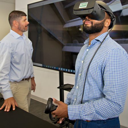
Virtual reality technology allows you to view the data for a completely immersive experience. High-res 360 degree images captured in the process can also be virtually navigated, similar to GoogleⓇ 'Street View'. With these tools, viewers can "see" the building before the construction begins.
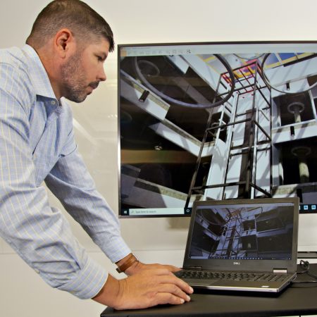
BUILDING INFORMATION MODELING (BIM)
Building Information Modeling (BIM) has been gaining popularity in architectural design and construction since its formal introduction by Autodesk in 2002, although the concept dates back to the 1980s. The Architectural, Engineering, and Construction (AEC) industry utilizes various 3D modeling programs to provide computer-aided models to improve overall project delivery. This process of using BIM in construction is known as Virtual Design and Construction (VDC).
With VDC, the architects and engineers provide 3D models of various building components including structure, architecture, and PME (Plumbing, Mechanical, and Electrical) systems. The design team and the builder can then run clash detections, a computer function that analyzes how systems interact, to determine design errors before any construction materials are purchased. This process allows the design team and client to make project decisions proactively instead of reactively and has been proven to save innumerable hours and countless dollars over the course of construction (i.e., fewer change orders). Schedule integrations and the ability to download real building component specifications into the model aid in scheduling and phasing exercises, as well as estimating and budgeting; this takes the 3D model to the fourth (time) and fifth (cost) dimensions. Leveraging state-of-the-art software, we can put the “power of BIM” in the hands of all of the people on our team, even those in the field. The model serves as a visual aid for onsite builders and tradespeople to better understand how an architectural detail should look. Finally, the 3-D model allows the client to see the finished product before construction starts. Textures, patterns, light, and space no longer need to be imagined; with high-quality rendered images, the client can see their building before it exists.
In an ideal world, VDC would be implemented on every project, however, it is not prioritized due to design schedule restraints, lack of VDC-trained personnel, and higher upfront costs (which ultimately save money in the end). To combat some of these natural pitfalls within the industry, CT Wilson Construction has hired an in-house 3-D modeler with over 30 years of construction experience. Field experience for a drafter is crucial when trying to determine how architectural designs will be interpreted and built in real life. This role bridges the information gaps to better serve the client long-term.
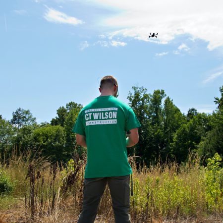
In addition to VDC, our Construction Technology department utilizes data collection and analysis tools to not only enhance BIM but also improve the overall project experience. Surveying tools like the Robotic Total Station and GNSS (Global Navigation Satelite System) Receivers use the power of satellite positioning for recording, layout, and Quality Assurance/Quality Control (QA/QC). Laser scanners capture existing conditions, which helps CT Wilson make informed design and construction decisions and aids facility managers in diagnosing potential future maintenance issues. Drones provide aerial surveying and thermal imaging capabilities to enhance constructability reviews and QA/QC inspections.